Roadtrip Indicators
Indicator species of climates from Detroit to Phoenix

This past week I had the great pleasure to drive cross-country with my brother and his fiancée. We began in Detroit and took the interstates via Albuquerque to Phoenix. The shifting climate was testified by the roadside vegetation. We witnessed the northeastern forests of Ohio and Illinois, the grasslands of Indiana, Missouri, and Oklahoma, the barren wastes of Texas, the cold high desert of New Mexico, a pine forest on Arizona’s east rim, and finally the low desert of the Phoenix valley.
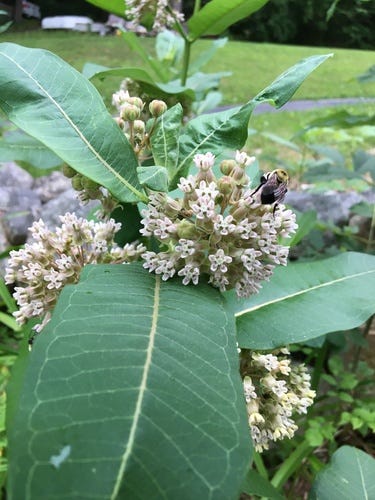
As we drove out of Detroit, all the roadside weeds were familiar. Milkweed (Asclepias syriaca) rules the banks on either side of the highway, taking the niche that mugwort (Artemisia vulgaris) owns in the somewhat wetter Northern New Jersey.
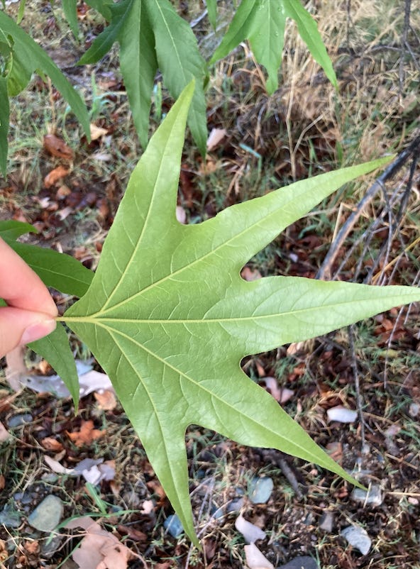
Tree of heaven (Ailanthus altissima)—the smelly, fast-growing invasive from East Asia—was the major successional tree initially, but as we entered Indiana, it gave way somewhat to sycamore (Patanus), noticeable from the car with its sunburst-shaped leaves.
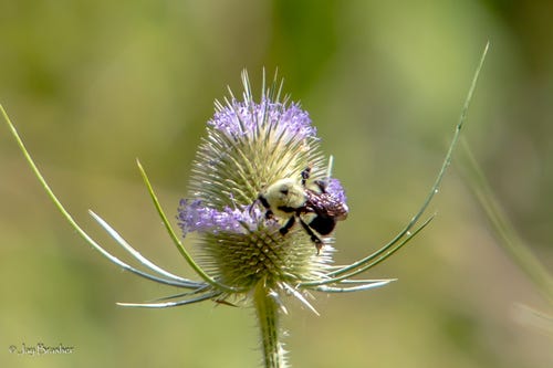
As we passed through St Louis, the climate was clearly becoming dryer. Milkweed gave way to teasel (Dipsacus fullonum), a curious plant with a dome-shaped flower cluster that blooms in two rings from top down and bottom up at same time. Then crossing Missouri, the trees all but disappeared, surviving only along water courses. To what extent this was due to dry climate or foraging livestock was unclear.
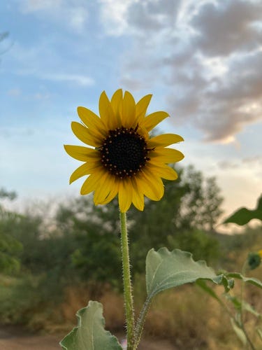
We then crossed the Texas panhandle, which was every bit as barren as Missouri, except that the roadside weeds now included tall and feisty wild sunflowers. Amazing how drought-tolerant these flowers must be.
Entering New Mexico, with increasing elevation and average temperature, we reached the high desert around Albuquerque. At one of the few rest stops, I tried the old crush-and-sniff technique on a little herb eeking out an existence in the sunbaked parking lot. I regretted it, as the leaves were heavily armored. Why is it that there are so many thorned plants in arid regions?
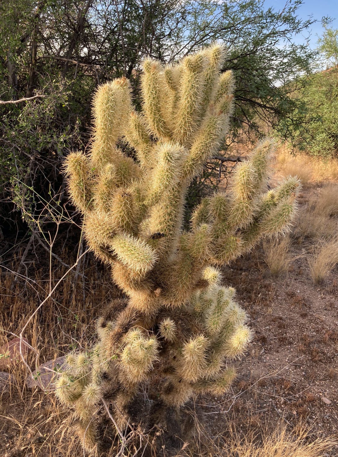
At this point the climate zones change very rapidly. It seems that every hill brought a somewhat different composition of thorny, shrubby vegetation, but at 80 mph all we could pick out was the teddybear cholla—the most widespread if not the most famous indicator species of the American desert.
Climbing up the Mongollon Rim—the transition zone between the Colorado Plateau and the Arizona basin—ponderosa pines towered above, forming a great montane forest dappled with clear lakes. Campers, anglers, and sightseers were everywhere, seeking some reprieve from the heat of the desert on all sides.
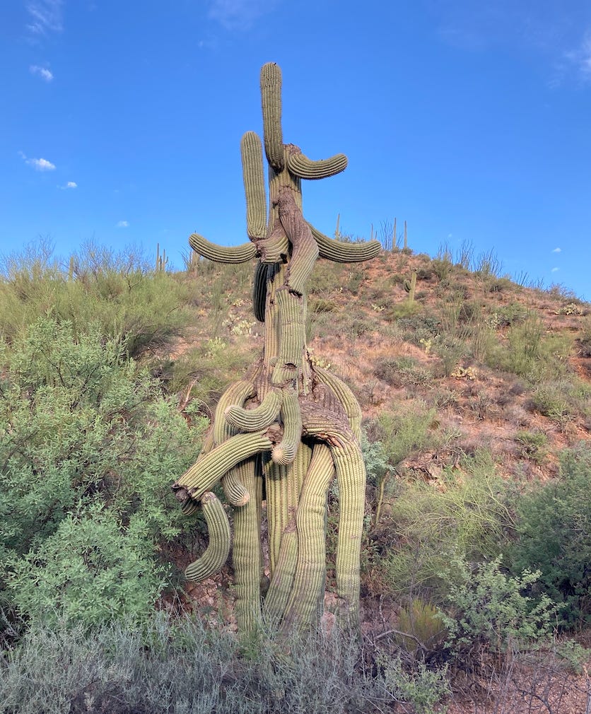
Finally, we descended the rim down towards Phoenix. As we rapidly dropped elevation, the pines vanished and only several switchbacks later appeared the Arizona state tree. We knew our destination was near.